Weather Alert in Montana
High Wind Warning issued February 26 at 11:39PM MST until February 27 at 5:00PM MST by NWS Billings MT
AREAS AFFECTED: Northern Stillwater; Golden Valley; Judith Gap; Northern Sweet Grass; Melville Foothills; Southern Wheatland
DESCRIPTION: * WHAT...West winds gusting 50 to 70 mph, strongest near the foothills. * WHERE...Portions of central and south central Montana. * WHEN...Until 5 PM MST Friday. * IMPACTS...Strong crosswinds will make travel difficult along Highway 191 from Big Timber through Judith Gap, and Highway 12 from Harlowton to Lavina. * ADDITIONAL DETAILS...Warm and dry conditions will cause rapid fire spread in wildland grasses.
INSTRUCTION: Winds this strong can make driving difficult, especially for high profile vehicles. Use extra caution and consider postponing travel until winds subside, or take an alternate route. Secure loose outdoor items. Use caution with any burning activities.
Want more detail? Get the Complete 7 Day and Night Detailed Forecast!
Current U.S. National Radar--Current
The Current National Weather Radar is shown below with a UTC Time (subtract 5 hours from UTC to get Eastern Time).

National Weather Forecast--Current
The Current National Weather Forecast and National Weather Map are shown below.

National Weather Forecast for Tomorrow
Tomorrow National Weather Forecast and Tomorrow National Weather Map are show below.

North America Water Vapor (Moisture)
This map shows recent moisture content over North America. Bright and colored areas show high moisture (ie, clouds); brown indicates very little moisture present; black indicates no moisture.

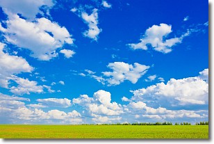
Weather Topic: What are Cumulus Clouds?
Home - Education - Cloud Types - Cumulus Clouds
 Next Topic: Drizzle
Cumulus clouds are fluffy and textured with rounded tops, and
may have flat bottoms. The border of a cumulus cloud
is clearly defined, and can have the appearance of cotton or cauliflower.
Cumulus clouds form at low altitudes (rarely above 2 km) but can grow very tall,
becoming cumulus congestus and possibly the even taller cumulonimbus clouds.
When cumulus clouds become taller, they have a greater chance of producing precipitation.
Next Topic: Drizzle
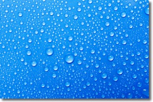
Weather Topic: What is Evaporation?
Home - Education - Precipitation - Evaporation
 Next Topic: Fog
Evaporation is the process which returns water from the earth
back to the atmosphere, and is another crucial process in the water cycle.
Evaporation is the transformation of liquid into gas, and it happens because
molecules are excited by the application of energy and turn into vapor.
In order for water to evaporate it has to be on the surface of a body of water.
Next Topic: Fog
Current conditions powered by WeatherAPI.com


