Weather Alert in Alaska
Winter Weather Advisory issued February 26 at 4:06PM AKST until February 26 at 9:00PM AKST by NWS Juneau AK
AREAS AFFECTED: Glacier Bay; Eastern Chichagof Island; Cape Fairweather to Lisianski Strait
DESCRIPTION: ...POTENTIAL OVERRUNNING SNOW EVENT FOR SUNDAY INTO MONDAY... .Cold Arctic air is expected to move into the panhandle for the end of the week into next week. With the cold air in place, moisture associated with a low over the Gulf into the Bering Sea is expected to move over the area. With the warmer nature of the moisture and colder air at the surface, snow is expected to fall across the Panhandle. Current guidance suggests that the most significant snow will be over the parts of the Central Panhandle that holds onto the cold air longer. There is the potential that this overrunning snow event lasts into the middle to end of next week. This will depend on how long the cold air persists through the Inner Channels. Meanwhile snow showers continue into the Thursday night for parts of the panhandle. * WHAT...For the Winter Weather Advisory, snow. Additional snow accumulations of up to two inches. For the Winter Storm Watch, heavy snow possible. Total snow accumulations of 6 to 12 inches possible. * WHERE...Glacier Bay, Eastern Chichagof Island and Cape Fairweather to Lisianski Strait. * WHEN...For the Winter Weather Advisory, until 9 PM AKST this evening. For the Winter Storm Watch, from Saturday morning through late Saturday night. * IMPACTS...Travel could be very difficult. * ADDITIONAL DETAILS...For the winter weather advisory, snow showers continue with visibility less then a mile at times possible. For the winter storm watch, Snow is expected to start Saturday morning and could potentially last into the start of next week with cold Arctic air in place and warm, moisture rich air moving over.
INSTRUCTION: Slow down and use caution while traveling. Monitor the latest forecasts for updates on this situation. People are urged to prepare their property before the onset of winter weather. For the latest road conditions, where available, call 5 1 1 or visit 511.alaska.gov.
Want more detail? Get the Complete 7 Day and Night Detailed Forecast!
Current U.S. National Radar--Current
The Current National Weather Radar is shown below with a UTC Time (subtract 5 hours from UTC to get Eastern Time).

National Weather Forecast--Current
The Current National Weather Forecast and National Weather Map are shown below.

National Weather Forecast for Tomorrow
Tomorrow National Weather Forecast and Tomorrow National Weather Map are show below.

North America Water Vapor (Moisture)
This map shows recent moisture content over North America. Bright and colored areas show high moisture (ie, clouds); brown indicates very little moisture present; black indicates no moisture.

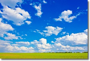
Weather Topic: What are Cumulus Clouds?
Home - Education - Cloud Types - Cumulus Clouds
 Next Topic: Drizzle
Cumulus clouds are fluffy and textured with rounded tops, and
may have flat bottoms. The border of a cumulus cloud
is clearly defined, and can have the appearance of cotton or cauliflower.
Cumulus clouds form at low altitudes (rarely above 2 km) but can grow very tall,
becoming cumulus congestus and possibly the even taller cumulonimbus clouds.
When cumulus clouds become taller, they have a greater chance of producing precipitation.
Next Topic: Drizzle
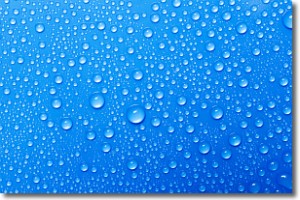
Weather Topic: What is Evaporation?
Home - Education - Precipitation - Evaporation
 Next Topic: Fog
Evaporation is the process which returns water from the earth
back to the atmosphere, and is another crucial process in the water cycle.
Evaporation is the transformation of liquid into gas, and it happens because
molecules are excited by the application of energy and turn into vapor.
In order for water to evaporate it has to be on the surface of a body of water.
Next Topic: Fog
Current conditions powered by WeatherAPI.com


