Weather Alert in Indiana
Flood Warning issued March 4 at 3:57AM EST by NWS Indianapolis IN
AREAS AFFECTED: Jackson, IN; Lawrence, IN; Washington, IN
DESCRIPTION: ...The National Weather Service in Indianapolis IN has issued a Flood Warning for the following rivers in Indiana... Big Blue River at Shelbyville. Driftwood River near Edinburgh. Flatrock River near Columbus. East Fork White River at Columbus. White River at Spencer. Eel River at Bowling Green. ...Forecast flooding changed from Minor to Moderate severity and increased in duration for the following rivers in Indiana... East Fork White River at Seymour. .Between 2 and 4 inches of rain have fallen across central Indiana as of early Wednesday morning. Up to 2 inches have fallen in south-central Indiana. This has led creeks to rise above flood stage and rivers will follow in the coming days. Additional rain is in the forecast over the next several days. * WHAT...Moderate flooding is forecast. * WHERE...East Fork White River at Seymour. * WHEN...From this afternoon until further notice. * IMPACTS...At 18.0 feet, Extensive flooding is in progress. More than 50 percent of the flood plain in Jackson County is underwater. Flood waters near the east edge of Medora. High water isolates wastewater treatment plant at Seymour. Many county roads that do not cross the river begin to flood. Many state and county roads are impassable by water. High water affects many rural residents, but only a few evacuations are necessary. Flood waters surround most river cabins. * ADDITIONAL DETAILS... - At 2:45 AM EST Wednesday the stage was 5.7 feet. - Forecast...The river is expected to rise above flood stage late this afternoon and continue rising to a crest of 17.8 feet Friday morning. - Flood stage is 12.0 feet. - http://www.weather.gov/safety/flood
INSTRUCTION: Motorists should not attempt to drive around barricades or drive cars through flooded areas. Additional information is available at www.weather.gov/ind. The next statement should be issued this evening by around 700 PM EST.
Want more detail? Get the Complete 7 Day and Night Detailed Forecast!
Current U.S. National Radar--Current
The Current National Weather Radar is shown below with a UTC Time (subtract 5 hours from UTC to get Eastern Time).

National Weather Forecast--Current
The Current National Weather Forecast and National Weather Map are shown below.

National Weather Forecast for Tomorrow
Tomorrow National Weather Forecast and Tomorrow National Weather Map are show below.

North America Water Vapor (Moisture)
This map shows recent moisture content over North America. Bright and colored areas show high moisture (ie, clouds); brown indicates very little moisture present; black indicates no moisture.

Weather Topic: What is Drizzle?
Home - Education - Precipitation - Drizzle
 Next Topic: Evaporation
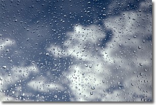
Drizzle is precipitation in the form of water droplets which are
smaller than raindrops.
Drizzle is characterized by fine, gently falling droplets and typically does not
impact human habitation in a negative way. The exception to this is freezing drizzle,
a condition where drizzle freezes immediately upon reaching earth's surface.
Freezing drizzle is still less dangerous than freezing rain, but can
potentially result in hazardous road conditions.
Next Topic: Evaporation
Weather Topic: What is Fog?
Home - Education - Cloud Types - Fog
 Next Topic: Fractus Clouds
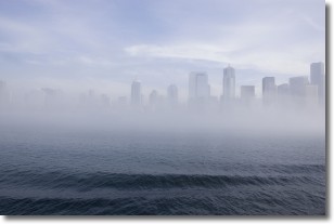
Fog is technically a type of stratus cloud, which lies along the
ground and obscures visibility.
It is usually created when humidity in the air condenses into tiny water droplets.
Because of this, some places are more prone to foggy weather, such as regions
close to a body of water.
Fog is similar to mist; both are the appearance of water droplets suspended in
the air, but fog is the term applied to the condition when visibility is less than 1 km.
Next Topic: Fractus Clouds
Current conditions powered by WeatherAPI.com


