Weather Alert in Maryland
Special Weather Statement issued February 27 at 4:08AM EST by NWS Baltimore MD/Washington DC
AREAS AFFECTED: Washington; Frederick; Carroll; Northern Baltimore; Cecil; Southern Baltimore; Northwest Montgomery; Central and Southeast Montgomery; Northwest Howard; Central and Southeast Howard; Northwest Harford; Southeast Harford; Augusta; Rockingham; Shenandoah; Frederick; Page; Warren; Clarke; Albemarle; Greene; Madison; Rappahannock; Orange; Culpeper; Fairfax; Northern Fauquier; Southern Fauquier; Eastern Highland; Western Loudoun; Eastern Loudoun; Northwest Prince William; Central and Southeast Prince William/Manassas/Manassas Park; Hampshire; Berkeley; Jefferson; Hardy; Eastern Grant; Eastern Pendleton
DESCRIPTION: Patchy fog has developed across much of the region, especially in valleys and other low lying areas. While visibilities may be variable, some fog is locally dense with visibility less than one quarter mile. Temperatures in many of these locations have fallen into the upper 20s and lower 30s, which could result in freezing fog. Any residual moisture from Thursday's rain could also result in icy spots. Expect the fog to gradually erode by mid morning. If driving early this morning, be prepared for rapidly changing conditions. Slow down, increase following distance, and use low beam headlights when encountering dense fog. Any road surfaces which appear wet may actually be icy.
INSTRUCTION: N/A
Want more detail? Get the Complete 7 Day and Night Detailed Forecast!
Current U.S. National Radar--Current
The Current National Weather Radar is shown below with a UTC Time (subtract 5 hours from UTC to get Eastern Time).

National Weather Forecast--Current
The Current National Weather Forecast and National Weather Map are shown below.

National Weather Forecast for Tomorrow
Tomorrow National Weather Forecast and Tomorrow National Weather Map are show below.

North America Water Vapor (Moisture)
This map shows recent moisture content over North America. Bright and colored areas show high moisture (ie, clouds); brown indicates very little moisture present; black indicates no moisture.

Weather Topic: What is Drizzle?
Home - Education - Precipitation - Drizzle
 Next Topic: Evaporation
Drizzle is precipitation in the form of water droplets which are
smaller than raindrops.
Drizzle is characterized by fine, gently falling droplets and typically does not
impact human habitation in a negative way. The exception to this is freezing drizzle,
a condition where drizzle freezes immediately upon reaching earth's surface.
Freezing drizzle is still less dangerous than freezing rain, but can
potentially result in hazardous road conditions.
Next Topic: Evaporation
Weather Topic: What is Fog?
Home - Education - Cloud Types - Fog
 Next Topic: Fractus Clouds
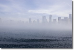
Fog is technically a type of stratus cloud, which lies along the
ground and obscures visibility.
It is usually created when humidity in the air condenses into tiny water droplets.
Because of this, some places are more prone to foggy weather, such as regions
close to a body of water.
Fog is similar to mist; both are the appearance of water droplets suspended in
the air, but fog is the term applied to the condition when visibility is less than 1 km.
Next Topic: Fractus Clouds
Current conditions powered by WeatherAPI.com


