Weather Alert in Kentucky
Winter Weather Advisory issued March 2 at 2:40AM EST until March 2 at 11:00AM EST by NWS Jackson KY
AREAS AFFECTED: Fleming; Bath; Rowan; Elliott
DESCRIPTION: * WHAT...Mixed precipitation expected. A light glaze of ice is anticipated on elevated surfaces. Minor snow and sleet accumulations of less than one inch are also possible. * WHERE...Bath, Elliott, Fleming, and Rowan Counties. * WHEN...Until 11 AM EST this morning. * IMPACTS...Untreated bridges, overpasses, and other elevated surfaces could become slick. Slippery road conditions could impact the Monday morning commute and linger through midday. * ADDITIONAL DETAILS...Temperatures are forecast to rise well above freezing by late Monday afternoon and remain relatively warmer overnight into Tuesday. This should allow any accumulations to melt off.
INSTRUCTION: Slow down and use caution while traveling. The latest road conditions for Kentucky can be found by visiting https://goky.ky.gov.
Want more detail? Get the Complete 7 Day and Night Detailed Forecast!
Current U.S. National Radar--Current
The Current National Weather Radar is shown below with a UTC Time (subtract 5 hours from UTC to get Eastern Time).

National Weather Forecast--Current
The Current National Weather Forecast and National Weather Map are shown below.

National Weather Forecast for Tomorrow
Tomorrow National Weather Forecast and Tomorrow National Weather Map are show below.

North America Water Vapor (Moisture)
This map shows recent moisture content over North America. Bright and colored areas show high moisture (ie, clouds); brown indicates very little moisture present; black indicates no moisture.

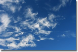
Weather Topic: What are Altostratus Clouds?
Home - Education - Cloud Types - Altostratus Clouds
 Next Topic: Cirrocumulus Clouds
Altostratus clouds form at mid to high-level altitudes
(between 2 and 7 km) and are created by a warm, stable air mass which causes
water vapor
to condense as it rise through the atmosphere. Usually altostratus clouds are
featureless sheets characterized by a uniform color.
In some cases, wind punching through the cloud formation may give it a waved
appearance, called altostratus undulatus. Altostratus clouds
are commonly seen with other cloud formations accompanying them.
Next Topic: Cirrocumulus Clouds
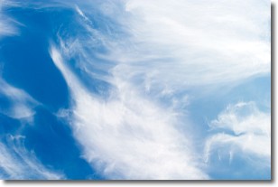
Weather Topic: What are Cirrostratus Clouds?
Home - Education - Cloud Types - Cirrostratus Clouds
 Next Topic: Cirrus Clouds
Cirrostratus clouds are high, thin clouds that form above
20,000 feet and are made mostly of ice crystals. They sometimes look like giant
feathers, horse tails, or curls of hair in the sky.
These clouds are pushed by the jet stream and can move at high speeds reaching
100 mph.
What do they indicate?
They indicate that a precipitation is likely within 24 hours.
Next Topic: Cirrus Clouds
Current conditions powered by WeatherAPI.com


