Weather Alert in Montana
Winter Weather Advisory issued February 26 at 1:30PM MST until February 28 at 2:00AM MST by NWS Missoula MT
AREAS AFFECTED: West Glacier Region
DESCRIPTION: ...GLACIER PARK AND HIGHWAY 2 SNOW - FRIDAY INTO SATURDAY... .A back door cold front will help create winter travel conditions in and near Glacier National Park as well as the Highway 2 corridor from West Glacier to Marias Pass from Friday into early Saturday morning. * WHAT...Snow and wind expected. There is a chance of minor to moderate winter weather impacts. Total snow accumulations between 2 and 6 inches along Highway 2 from West Glacier to Marias Pass. Total snow accumulations of up to 10 inches above the pass, with locally higher amounts possible in the higher peaks. Wind gusts up to 65 mph could cause blowing and drifting of snow and decreased visibility to less than one-half mile at times. * WHERE...Glacier National Park, Polebridge, Essex, Highway 83 Bigfork to Swan Lake, Marias Pass, and Bad Rock Canyon. * WHEN...From noon Friday to 2 AM MST Saturday. * IMPACTS...For MINOR winter weather impacts, expect a few inconveniences to normal activities. Use caution while driving. Winter traveling conditions. The hazardous conditions could impact the Friday evening commute, especially over higher passes.
INSTRUCTION: Slow down and use caution while traveling. The latest road conditions for the state you are calling from can be obtained by calling 5 1 1.
Want more detail? Get the Complete 7 Day and Night Detailed Forecast!
Current U.S. National Radar--Current
The Current National Weather Radar is shown below with a UTC Time (subtract 5 hours from UTC to get Eastern Time).

National Weather Forecast--Current
The Current National Weather Forecast and National Weather Map are shown below.

National Weather Forecast for Tomorrow
Tomorrow National Weather Forecast and Tomorrow National Weather Map are show below.

North America Water Vapor (Moisture)
This map shows recent moisture content over North America. Bright and colored areas show high moisture (ie, clouds); brown indicates very little moisture present; black indicates no moisture.

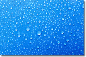
Weather Topic: What is Condensation?
Home - Education - Precipitation - Condensation
 Next Topic: Contrails
Condensation is the process which creates clouds, and therefore
it is a crucial process in the water cycle.
Condensation is the change of matter from a state of gas into a state of liquid,
and it happens because water molecules release heat into the atmosphere and
become organized into a more closely packed structure, what we might see as
water droplets.
Water is always present in the air around us as a vapor, but it's too small for
us to see. When water undergoes the process of condensation it becomes organized
into visible water droplets. You've probably seen condensation happen before on the
surface of a cold drink!
Next Topic: Contrails
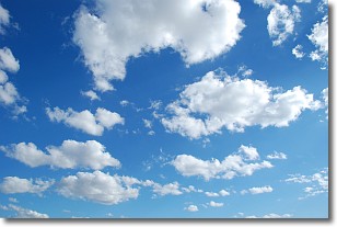
Weather Topic: What are Cumulonimbus Clouds?
Home - Education - Cloud Types - Cumulonimbus Clouds
 Next Topic: Cumulus Clouds
The final form taken by a growing cumulus cloud is the
cumulonimbus cloud, which is very tall and dense.
The tower of a cumulonimbus cloud can soar 23 km into the atmosphere, although
most commonly they stop growing at an altitude of 6 km.
Even small cumulonimbus clouds appear very large in comparison to other cloud types.
They can signal the approach of stormy weather, such as thunderstorms or blizzards.
Next Topic: Cumulus Clouds
Current conditions powered by WeatherAPI.com


