Weather Alert in South Dakota
Red Flag Warning issued February 26 at 10:04PM MST until February 27 at 6:00PM MST by NWS Rapid City SD
AREAS AFFECTED: Bennett County Area; Mellette and Todd Counties
DESCRIPTION: ...RED FLAG WARNING IN EFFECT FROM NOON MST/100 PM CST TO 600 PM MST/700 PM CST FRIDAY FOR GUSTY WINDS AND LOW RELATIVE HUMIDITY FOR FIRE WEATHER ZONES 315, 317, 322, 326, 333, 334, AND 335... .Very dry air will affect parts of northeastern Wyoming as well as far southwestern into south-central South Dakota Friday afternoon. Minimum relative humidities will drop to 15 to 20 percent as northwest winds blow at 10 to 25 mph with gusts from 25 to 40 mph, strongest over south-central South Dakota. Antecedent D1 to D2 drought conditions will exacerbate the fire potential. The combination of low humidity values and gusty winds will create critical fire weather conditions on Friday for these areas. The National Weather Service in Rapid City has issued a Red Flag Warning for gusty winds and low relative humidity, which is in effect from noon MST /1 PM CST/ to 6 PM MST /7 PM CST/ Friday. * AFFECTED AREA...Fire Weather Zones 333 Bennett County Area and 334 Mellette and Todd Counties. * WINDS...Northwest 15 to 25 mph with gusts up to 30 mph. * RELATIVE HUMIDITY...As low as 15 to 18 percent. * IMPACTS...The combination of gusty winds and low relative humidity would produce critical fire weather conditions.
INSTRUCTION: A Red Flag Warning means that critical fire weather conditions are either occurring now, or will shortly. A combination of strong winds, low relative humidity, and warm temperatures can contribute to extreme fire behavior.
Want more detail? Get the Complete 7 Day and Night Detailed Forecast!
Current U.S. National Radar--Current
The Current National Weather Radar is shown below with a UTC Time (subtract 5 hours from UTC to get Eastern Time).

National Weather Forecast--Current
The Current National Weather Forecast and National Weather Map are shown below.

National Weather Forecast for Tomorrow
Tomorrow National Weather Forecast and Tomorrow National Weather Map are show below.

North America Water Vapor (Moisture)
This map shows recent moisture content over North America. Bright and colored areas show high moisture (ie, clouds); brown indicates very little moisture present; black indicates no moisture.

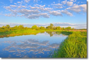
Weather Topic: What are Stratocumulus Clouds?
Home - Education - Cloud Types - Stratocumulus Clouds
 Next Topic: Stratus Clouds
Stratocumulus clouds are similar to altocumulus clouds in their
fluffy appearance, but have a slightly darker shade due to their additional mass.
A good way to distinguish the two cloud types is to hold your hand out and measure
the size of an individual cloud; if it is the size of your thumb it is generally
an altocumulus cloud, if it is the size of your hand it is generally a
stratocumulus cloud.
It is uncommon for stratocumulus clouds to produce precipitation, but if they do
it is usually a light rain or snow.
Next Topic: Stratus Clouds
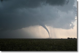
Weather Topic: What are Wall Clouds?
Home - Education - Cloud Types - Wall Clouds
 Next Topic: Altocumulus Clouds
A wall cloud forms underneath the base of a cumulonimbus cloud,
and can be a hotbed for deadly tornadoes.
Wall clouds are formed by air flowing into the cumulonimbus clouds, which can
result in the wall cloud descending from the base of the cumulonimbus cloud, or
rising fractus clouds which join to the base of the storm cloud as the wall cloud
takes shape.
Wall clouds can be very large, and in the Northern Hemisphere they generally
form at the southern edge of cumulonimbus clouds.
Next Topic: Altocumulus Clouds
Current conditions powered by WeatherAPI.com


