Weather Alert in California
Beach Hazards Statement issued April 4 at 10:46AM PDT until April 6 at 11:00PM PDT by NWS Eureka CA
AREAS AFFECTED: Coastal Del Norte; Northern Humboldt Coast; Southwestern Humboldt; Mendocino Coast
DESCRIPTION: * WHAT...Increased threat of sneaker waves expected. * WHERE...Coastal Del Norte, Northern Humboldt Coast, Southwestern Humboldt and Mendocino Coast Counties. * WHEN...From late Saturday night through Sunday evening. . * IMPACTS...Large, unexpected waves can sweep across the beach without warning, sweeping people into the sea from rocks, jetties, and beaches. These sneaker waves can also move large objects such as logs, crushing anyone caught underneath.
INSTRUCTION: Don't be fooled by an ocean that looks calm. There can be 30 minutes of small waves before a sneaker wave strikes. Avoid rocks and jetties. Avoid steep beaches. Stay much farther back from the water and never turn your back on the ocean.
Want more detail? Get the Complete 7 Day and Night Detailed Forecast!
Current U.S. National Radar--Current
The Current National Weather Radar is shown below with a UTC Time (subtract 5 hours from UTC to get Eastern Time).

National Weather Forecast--Current
The Current National Weather Forecast and National Weather Map are shown below.

National Weather Forecast for Tomorrow
Tomorrow National Weather Forecast and Tomorrow National Weather Map are show below.

North America Water Vapor (Moisture)
This map shows recent moisture content over North America. Bright and colored areas show high moisture (ie, clouds); brown indicates very little moisture present; black indicates no moisture.

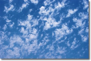
Weather Topic: What are Fractus Clouds?
Home - Education - Cloud Types - Fractus Clouds
 Next Topic: Freezing Rain
A fractus cloud (scud) is a fragmented, tattered cloud which has
likely been sheared off of another cloud. They are accessory clouds, meaning they
develop from parent clouds, and are named in a way which describes the original
cloud which contained them.
Fractus clouds which have originated from cumulus clouds are referred to as
cumulus fractus, while fractus clouds which have originated from stratus clouds
are referred to as stratus fractus. Under certain conditions a fractus cloud might
merge with another cloud, or develop into a cumulus cloud, but usually a
fractus cloud seen by itself will dissipate rapidly.
They are often observed on the leading and trailing edges of storm clouds,
and are a display of wind activity.
Next Topic: Freezing Rain
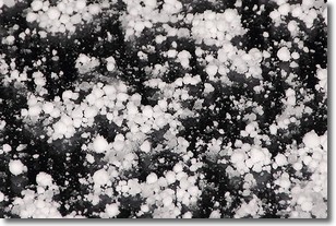
Weather Topic: What is Graupel?
Home - Education - Precipitation - Graupel
 Next Topic: Hail
Graupel is a form of precipitation that is created by atmospheric conditions
which cause supercooled water droplets to contact snow crystals and freeze to
their surface.
Sometimes known as soft hail or snow pellets, graupel is delicate and easily
destroyed by touch. Whereas hail usually falls during severe weather, graupel
doesn't require such conditions to form, and can form in mild precipitation
similar to situations which produce snowfall.
Next Topic: Hail
Current conditions powered by WeatherAPI.com


