Weather Alert in Alabama
Flood Advisory issued February 26 at 9:12PM CST until February 26 at 11:15PM CST by NWS Birmingham AL
AREAS AFFECTED: Pickens, AL; Tuscaloosa, AL
DESCRIPTION: * WHAT...Urban and small stream flooding will remain possible through the evening with additional heavy rain expected to move into the advisory area with already saturated soil conditions. * WHERE...A portion of central Alabama, including the following counties, Pickens and Tuscaloosa. * WHEN...Until 1115 PM CST. * IMPACTS...Minor flooding in low-lying and poor drainage areas. Water over roadways. River or stream flows are elevated. * ADDITIONAL DETAILS... - At 910 PM CST, Heavy rain and thunderstorms are expected to return across the advisory area through the late evening hours. This will likely cause urban and small stream flooding. - Some locations that will experience flooding include... Gordo, Reform, Ethelsville, Samantha, Binion Creek Landing, Bankhead Lock And Dam, Bull City, Moores Bridge, Lubbub, Echola, Tierce Pattton Bridge, North Pickens Airport, Highway 69 Bridge, Lake Tuscaloosa, Owens, Windham Springs, Shaw, Wiley, McShan and Whitson.
INSTRUCTION: Turn around, don't drown when encountering flooded roads. Most flood deaths occur in vehicles. Be especially cautious at night when it is harder to recognize the dangers of flooding.
Want more detail? Get the Complete 7 Day and Night Detailed Forecast!
Current U.S. National Radar--Current
The Current National Weather Radar is shown below with a UTC Time (subtract 5 hours from UTC to get Eastern Time).

National Weather Forecast--Current
The Current National Weather Forecast and National Weather Map are shown below.

National Weather Forecast for Tomorrow
Tomorrow National Weather Forecast and Tomorrow National Weather Map are show below.

North America Water Vapor (Moisture)
This map shows recent moisture content over North America. Bright and colored areas show high moisture (ie, clouds); brown indicates very little moisture present; black indicates no moisture.

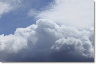
Weather Topic: What are Nimbostratus Clouds?
Home - Education - Cloud Types - Nimbostratus Clouds
 Next Topic: Precipitation
A nimbostratus cloud is similar to a stratus cloud in its formless,
smooth appearance. However, a nimbostratus cloud is darker than a stratus cloud,
because it is thicker.
Unlike a stratus cloud, a nimbostratus cloud typically brings with it the threat
of moderate to heavy precipitation. In some cases, the precipitation may evaporate
before reaching the ground, a phenomenon known as virga.
Next Topic: Precipitation
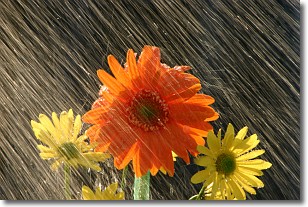
Weather Topic: What is Rain?
Home - Education - Precipitation - Rain
 Next Topic: Shelf Clouds
Precipitation in the form of water droplets is called rain.
Rain generally has a tendency to fall with less intensity over a greater period
of time, and when rainfall is more severe it is usually less sustained.
Rain is the most common form of precipitation and happens with greater frequency
depending on the season and regional influences. Cities have been shown to have
an observable effect on rainfall, due to an effect called the urban heat island.
Compared to upwind, monthly rainfall between twenty and forty miles downwind of
cities is 30% greater.
Next Topic: Shelf Clouds
Current conditions powered by WeatherAPI.com


