Weather Alert in Indiana
Flood Advisory issued March 4 at 7:31AM EST until March 4 at 11:00AM EST by NWS Indianapolis IN
AREAS AFFECTED: Decatur, IN; Hancock, IN; Henry, IN; Rush, IN; Shelby, IN
DESCRIPTION: * WHAT...Flooding caused by excessive rainfall continues. * WHERE...Northern Decatur County in central Indiana... Southeastern Hancock County in central Indiana... Rush County in central Indiana... Northern Shelby County in central Indiana... South Central Henry County in east central Indiana... * WHEN...Until 1100 AM EST. * IMPACTS...Minor flooding in low-lying and poor drainage areas. River or stream flows are elevated. * ADDITIONAL DETAILS... - At 726 AM EST, Doppler radar indicated heavy rain due to thunderstorms overnight and stream gauges show elevated levels with some indicating minor flooding. Between 2 and 3.5 inches of rain have fallen. - Some locations that will experience flooding include... Shelbyville, Greensburg, Rushville, Adams, Knightstown, Milford, Morristown, St. Paul, Carthage, Fairland, Milroy, Glenwood, Arlington, Manilla, Moscow, Sandusky, New Salem, Mays, Clarksburg and Lake Santee. - http://www.weather.gov/safety/flood
INSTRUCTION: Turn around, don't drown when encountering flooded roads. Most flood deaths occur in vehicles.
Want more detail? Get the Complete 7 Day and Night Detailed Forecast!
Current U.S. National Radar--Current
The Current National Weather Radar is shown below with a UTC Time (subtract 5 hours from UTC to get Eastern Time).

National Weather Forecast--Current
The Current National Weather Forecast and National Weather Map are shown below.

National Weather Forecast for Tomorrow
Tomorrow National Weather Forecast and Tomorrow National Weather Map are show below.

North America Water Vapor (Moisture)
This map shows recent moisture content over North America. Bright and colored areas show high moisture (ie, clouds); brown indicates very little moisture present; black indicates no moisture.

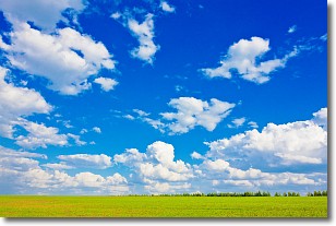
Weather Topic: What are Cumulus Clouds?
Home - Education - Cloud Types - Cumulus Clouds
 Next Topic: Drizzle
Cumulus clouds are fluffy and textured with rounded tops, and
may have flat bottoms. The border of a cumulus cloud
is clearly defined, and can have the appearance of cotton or cauliflower.
Cumulus clouds form at low altitudes (rarely above 2 km) but can grow very tall,
becoming cumulus congestus and possibly the even taller cumulonimbus clouds.
When cumulus clouds become taller, they have a greater chance of producing precipitation.
Next Topic: Drizzle
Weather Topic: What is Evaporation?
Home - Education - Precipitation - Evaporation
 Next Topic: Fog
Evaporation is the process which returns water from the earth
back to the atmosphere, and is another crucial process in the water cycle.
Evaporation is the transformation of liquid into gas, and it happens because
molecules are excited by the application of energy and turn into vapor.
In order for water to evaporate it has to be on the surface of a body of water.
Next Topic: Fog
Current conditions powered by WeatherAPI.com


